M2.1 Shortest-Route Problem Solved Using Dynamic Programming
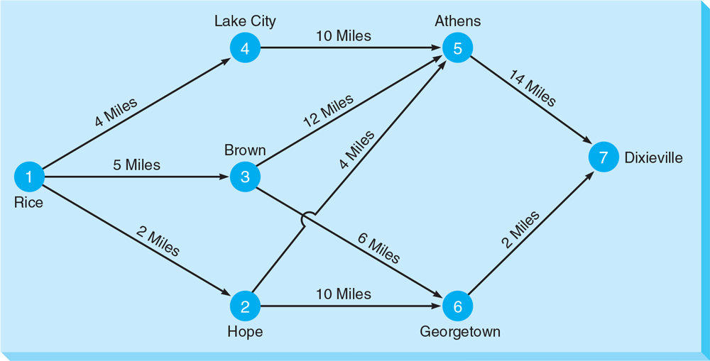
George Yates is about to make a trip from Rice, Georgia (1), to Dixieville, Georgia (7). George would like to find the shortest route. Unfortunately, there are a number of small towns between Rice and Dixieville. His road map is shown in Figure M2.1.

Figure M2.1 Highway Map Between Rice and Dixieville
The circles on the map, called nodes, represent cities such as Rice, Dixieville, Brown, and so on. The arrows, called arcs, represent highways between the cities. The distance in miles is indicated along each arc. This problem can, of course, be solved ...
Get Quantitative Analysis for Management, 13/e now with the O’Reilly learning platform.
O’Reilly members experience books, live events, courses curated by job role, and more from O’Reilly and nearly 200 top publishers.

