Mapping the density of points using a hexagonal grid has become quite a popular alternative to creating heatmaps. Load the popp.shp layer into the Layers panel. We will build a grid based on the extent of the landcover.img layer. Each cell in the grid will ultimately contain a count of points that fall in each cell. Processing offers us a fast way to create such an analysis. To create a grid, search Create Grid in the Processing Toolbox. After doing this, fill in the dialog box as follows and select Hexagon (polygon) as the Grid type:
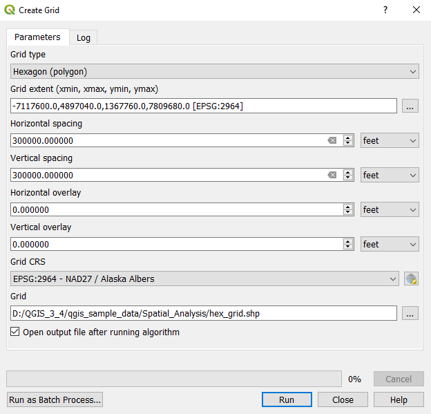
Creating a hexagonal grid
Search for Count Points in Polygon in the toolbox ...

