Appendix
General Map Symbols
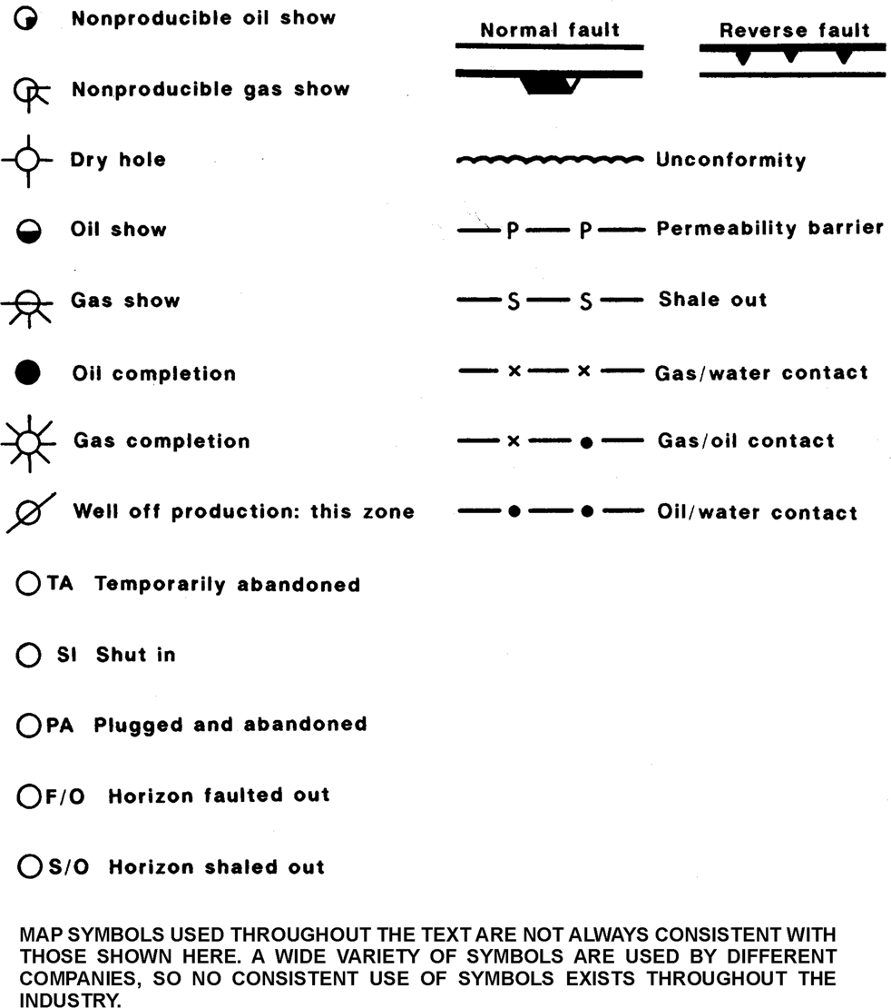
Figure A-1 Map symbols.
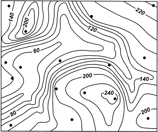
Figure A-2 Map constructed using the interpretive contouring technique. (Reproduced from Analysis of Geologic Structures by John M. Dennison, by permission of W. W. Norton & Company, Inc. Copyright © 1968 by W. W. Norton & Company, Inc.)
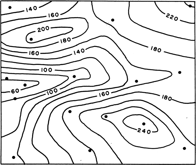
Figure A-3 Map constructed using the mechanical contouring technique. (Reproduced from Analysis of Geologic Structures by John M. Dennison, by permission ...
Get Applied Three-Dimensional Subsurface Geological Mapping: With Structural Methods, 3rd Edition now with the O’Reilly learning platform.
O’Reilly members experience books, live events, courses curated by job role, and more from O’Reilly and nearly 200 top publishers.

